
The Dingle Way is a 180km trail that loops around the Dingle Peninsula in the south west of Ireland. It is a trail of many tails – seen in the history and ruins of the Irish landscape; connected to the blizzards of Antarctica and heatwaves of high Spanish noon; and where I stood on a humpback bridge, the land flooded around me, crying for the beauty of what I saw, and for the broken foot I had to walk ten more kilometres on. But that comes later.
My name is Ellie, I’m one half of Tough Soles. Tough Soles is a project between myself and my partner Carl that started off with the goal to hike all of Ireland’s National Waymarked Trails. Between 2017 – 2019 we did just that, quitting our jobs every summer to live on the trails and walk our way around the country. Today I’m sharing my experience of the Dingle Way, our 19th out of the 42 National Waymarked Trails of Ireland.
We walked this trail over 8 days, with two rest days within that time – one taken out of choice, and once forced because of a storm. We started the trail in Tralee, and walked the loop clockwise around the peninsula. Below are the stages we approached the trail in, and are the typical stages that most people use when planning their own hike of the trail.
Trail Stages
Day 1: Tralee to Camp
Day 2: Camp to Annascaul
Day 3: Annascaul to Dingle
Day 4: Rest Day Dingle
Day 5: Dingle – Dunquin
Day 6: Rest Day – Storm
Day 7: Dunquin – Ballygar
Day 8: Ballygar – Cloghane
Day 9: Cloghane – Aughacasla
Day 10: Aughacasla – Camp

The first three days/roughly 70km of the Dingle Way is also known as the Kerry Camino. The story goes that Saint Brendan (born along the North Kerry Way) travelled from Dingle and across the seas to spread Christianity, eventually reaching North America. Pilgrims in the past would also sail from Dingle to Spain to walk the Camino de Santiago. From this story the Kerry Camino has been born. Along this section of the trail there are stamp stations (sometimes a pub, sometimes a letterbox left on the side of a mountain), and by collecting these stamps you can claim your pilgrim certificate at the end of your three days.

Day 1: Tralee – Camp
Leaving Tralee and passing the Blennerville Windmill, we started this trail in glorious sunshine. The trail twists and winds its way along the feet of the mountains, with the steep slopes on your left and the coastline out to your right. For this first 20km section the trail is rustic but well defined, featuring ample benches to relax at, as well as untouched stepping stone river crossings that truly immerse you in the beauty of the place.

Day 2: Camp – Annascaul
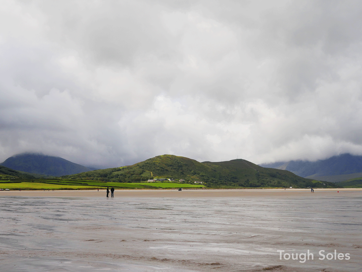
For us, day two couldn’t have been more different. Stepping onto the trail that morning we started the slow climb that would take us through the mountains to the south side of the peninsula, and promptly lost ourselves in the clouds. Like many Irish trails there is some road walking, and this stage features small lanes and old access roads through forests. As the rain settled over the mountains for the day we walked with our hoods up, each in our own world. On reaching the south shores we found ourselves at Inch, a long beach that stretches out towards the Iveragh Peninsula south of us, home to the McGillicuddy’s Reeks and Killarney National Park. The weather was gracious enough to give us a moment’s rest as we looked out. No matter what trail you choose to walk in Kerry, you will always have views of far away mountains, shrouded in dark blues and purples as they rise up – high enough that you have to push your hood back to see the full view.
From Inch the trail has one more climb, before you crest the hill and see the village of Annascaul at the bottom of the valley. It’s here that you’ll find the South Pole Inn, a pub opened by the arctic explorer Tom Crean. The walls are filled with the maps, books, and photographs of his expeditions, and even the more tired soul will be inspired to lace their boots tighter the next day.

Day 3: Annascaul – Dingle
Leaving Annascaul the trail climbs back out of the valley the small village is nestled in, hitting the coast briefly at Minard Castle before climbing uphill once more. The terrain for the day is farmland, backroads, and open hillsides, the small streams becoming fast flowing fountains after the rain of the day before. We zig zag our way across the hills, fuschia bushes covering the slopes in bright reds and pinks. All the winding and climbing that day brought us up to a low pass, which offered us amazing views of Dingle town ahead. Once the final destination for a day is within eyesight, the final few kilometres are always smoother under foot.
Day 4: Rest Day Dingle
Having completed the Kerry Camino section of the trail, and reached the namesake town of the trail, we took a rest day in Dingle. From Dingle onwards the trail stages are slightly longer distance, and also more strenuous.

Day 5: Dingle – Dunquin
Day five is the day that we reach the end of the peninsula and cross onto its northern half, with the highlight of the day being the view of the Blasket Islands. Leaving Dingle the trail has the option to walk along the beach, or follow the inland road if the tide is high. We’re lucky with our timing and just about squeeze in a beach crossing. It’s then open hills and sheep tracks as the Way follows the mountainside as it banks around to the north. As you slowly round the headland the world opens up in front of you – the sea glistening so turquoise it looks like it’s from a dream, windswept cliffs cutting sharp lines through it, and a horizon that goes for miles and miles.
Day 6: Rest Day (Storm)
The west coast of Ireland is famous (or infamous) for its wild weather, and so it was unsurprising that a storm rolled in, inflicting a forced, but not begrudged, rest day. At this point we had been hiking non-stop for over four months around this small island, and had learnt that bad weather days happen, and are just part of the through-hiking experience here.

Day 7: Dunquin – Ballygar
A short way from Dunquin the trail brings you right past the Blasket Island visitor centre, where there’s coffee and cakes, and also the chance to cross over and visit the islands, depending on how strict your hiking schedule is. Passing on, the trail starts making it’s way towards the biggest climb of the whole route – Mount Brandon.
Day 8: Ballygar – Cloghane
The Dingle Way crosses over through a col between Masatiompan and the main Mount Brandon ridgeline.
The approach was a steady incline the whole way up, with several faux-summits. It was the first day in a long time that we’d gone from sea level to 700+meters, and back to sea level in just a few hours. The trail takes you up a small pass beside Mt. Brandon, with the side we went up being approachable with relatively even footing, a clear route and easily followed waymarkers. On reaching the pass/col there’s a standing stone sitting by itself in the middle. It’s believed to be a 1400 year old ancient Ogham Stone from the 6th century, and thought to be the highest Ogham stone in Ireland. Both the history and the views were breathtaking. Small wisps of clouds streamed below us, settling in lower corries and lakes. The higher, larger clouds dappled the whole peninsula out and around us, our views extending as far as several days walk away.

The side we went down (the north side) was much more mountainous, the trail less defined, with more scrambling and sliding. Once we had descended a few hundred meters again the trail turned into a dirt track and as we continued our way downhill the mountains around us were all shades of golden and navy. Back at sea level we took a breather, as there were still a few kilometres from here to the village of Cloghane. The views of the ocean carried us through the evening.
Day 9: Cloghane – Aughacasla
Waking up the next day, we decided to be ambitious and see if we could finish the trail that day. We knew it would be long, but it was mostly beach walking, which looked very straight forward – at least 22km of beach to be specific. This beach stretch saw us walk along the biggest sand spit you could imagine. Up one side, and back down the other. It was long, but it was beautiful. Having spent months hiking in boots, we freed our toes for the day and rolled up our trousers. We waded through small river mouths, and scampered across short tarmac sections, bare feet feeling tired but amazing.

However, because we were just generally having a good time, I didn’t really pay attention to how much of the beach I’d walked in my bare feet. I knew that I was out of practice walking without shoes on. Sand is soft, causing the muscles and tendons in your feet to work twice as hard. For so much of the day I was fine, and then suddenly the discomfort was building, the pain getting sharper, and I was no longer walking, but awkwardly hobbling. I tried to act like it was nothing, in personal denial that I might have just hurt myself. Reaching the end of the beaches and bare feet, I internally started to panic. My foot was sore. But we were so close to the end. Probably 15km? I’ve walked that before breakfast, how can I not walk it now? I inexpertly taped up my foot, wondering if that could really do anything, and said it was fine.
So we continued on.
We got about 3km down the road and I knew I couldn’t walk. Rounding a corner, I laughed out loud. The road was flooded. About half a kilometre down the road I could see the top of a hunchback bridge sticking up like a small island. It wasn’t deep: calf submerged, but not above my whole knee. Carl just went straight in wearing his shoes. I changed into my sandals and followed. I made it to the bridge and just started crying. I was so sore. So unbelievably sore. But I couldn’t hurt myself. We had so much more to do. And the flooding looked incredibly beautiful in the sunset. So I also started laughing. Laughing and crying. After a few minutes I was ready, and we waded another kilometre or so to dry road again. I hobbled, limped, and we made it to a campsite somewhere after Castlegregory.

Day 10: Aughacasla – Camp
The next morning we packed up. It was only 12km to the end. Carl took my backpack, carrying all the weight. I think I probably went into a mild form of shock as we pushed on. And let me say, Carl said we should stop many times. My family had offered to collect me. But I really wanted to finish this one. It had been too good until then. I couldn’t not finish one of the best trails we’d done so far. And in my mind I was still refusing to believe that I could have injured myself.
We got to Camp, and that closed the loop. We were finished.
The Dingle Way is a breathtaking trail, and still one of my absolute favourites – despite the several stress fractures that were spread throughout my right foot after it. This story is very experience heavy, because my experience of it was so intense. I promise, no one else that I know who has hiked it has come away with my injury.Like much of the west coast, the Dingle Peninsula offers so much – it’s constantly changing landscapes boggling the mind and stealing the heart, and freeing the soul.
This is one of 42 trails that Carl and I have walked across Ireland. Thanks to Hiiker for sharing our adventure along this particular Way. If you want to hear us talk about our adventures, we’ve been on the Hiiker Podcast.
For more, check out toughsoles.ie. Find us on youtube and social media.