
A true taste of the Cotswolds
Beautifully distinctive honey-coloured stone, quaint villages that seem to have been frozen in time, traditional dry stone walls at every turn; picturesque pubs and manicured gardens with creeping roses… I think if you’d never been to England before this is what you would imagine it all to look like.

‘The Cotswolds’ spans across five counties yet I’d never seen its ‘chocolate box’ houses or its idyllic staycation spots but now I’ve walked 102 miles right through the middle I know exactly why it is so loved.
The Cotswold Way is an undulating and well-marked 102-mile long-distance trail starting from Chipping Campden and taking you right into the centre of Bath and it can be hiked in either direction.

Long-distance hiking
There’s something special about ‘thru-hiking’ and wild camping a long-distance trail; knowing you’re going to be hiking the entire trail at once and moving in one direction to reach the finish line all under your own steam. It’s about passing through the countryside and villages at a slower pace, having time to take it all in and see the views you never would have if you had driven through or stopped in for tea.
You sit under trees, rest on benches, and eat in villages you never knew existed; speak to local people, visit the local pubs, and buy your vital supplies in local shops. It’s a connection like no other and by being on foot with just a bag on your back you’re exposed but open to all experiences – just a visitor but a local in that moment, it opens you up to a place in a totally unique way.
I must note that when it comes to wild camping we strictly adhere to the Leave No Trace rules and always try to find wild spots away from the trail where we cannot be seen and leave them just as we found them, packing out litter if and when we find it.
A dash of history
The Cotswolds are known for the Cotswold Stone, discovered by the Romans and is rich in Oolitic Limestone. Readily available from the surrounding hillsides, it was the natural choice when it came to building towns and cities all over the Cotswolds and is still quarried today.
The Cotswold Way takes you through several of this Area of Outstanding Natural Beauty’s most popular spots, including Chipping Campden, Painswick, and Broadway, just a few of the ‘chocolate box’ villages to explore in the area.
The terrain
Overall, the Cotswold Way has some good long climbs and descents, many magnificent views and the terrain is wonderfully varied. There is a mixture of woodland sections and pasture, farm track and bridleways, and sections of quiet country road.

The route
We parked in Bath and started in Chipping Campden, but we’d been told by a fellow hiker that the closer to Bath you get, the bigger the towns are, which we found to be true. So, if you’d prefer to end in the smaller picturesque villages you might want to head towards Chipping Campden.

Day 1
From Chipping Campden we began the 102-mile hike along pasture and farmland, following the iconic dry stone walls that would eventually lead us to Bath. A well-marked trail, it was nice to be able to spend less time navigating and more time enjoying the endless views.
The route takes you right past Broadway Tower, the highest ‘castle’ in the Cotswolds, where you can rent bikes, walk through the Deer Park, visit the shop, stop for a coffee, or get a guided tour of the Nuclear Bunker. You then descend into the town of Broadway. A quintessential country village, with perfect gardens, chocolate box houses and a bustling high street with plenty of shops, cafes, and resupply options.
Despite the abundance of towns and villages on this trail, one thing we noticed from day one was the lack of water points, so when we found any we added them to the Hiiker App straight away.
Certainly not a hike for anyone wanting to get solely lost in nature, part of the charm of the Cotswold Way is going through its towns and villages which for the first 50 miles look like they’re straight out of a Harry Potter film. (I’m not ashamed to admit I was convinced that the village of Stanton was actually Godric’s Hollow, but a quick Google sadly proved me wrong.)
At the end of day one we headed through the charming medieval town of Winchcombe, a timeless picturesque town that’s home to Sudeley Castle as well as a host of shops, takeaways, and accommodation options. After filling our packs with snacks and dinner we headed out of town to find a good wild camp spot, stopping at a pub on the way out to fill up our water bottles, and sadly only with water.
We found ourselves at Belas Knap Barrow at mile 20, a burial mound just on the outskirts of Winchcombe and ‘a fine example of a Neolithic long barrow, excavated in 1863 and 1865, the remains of 31 people were found in the chambers’ and has since been restored.
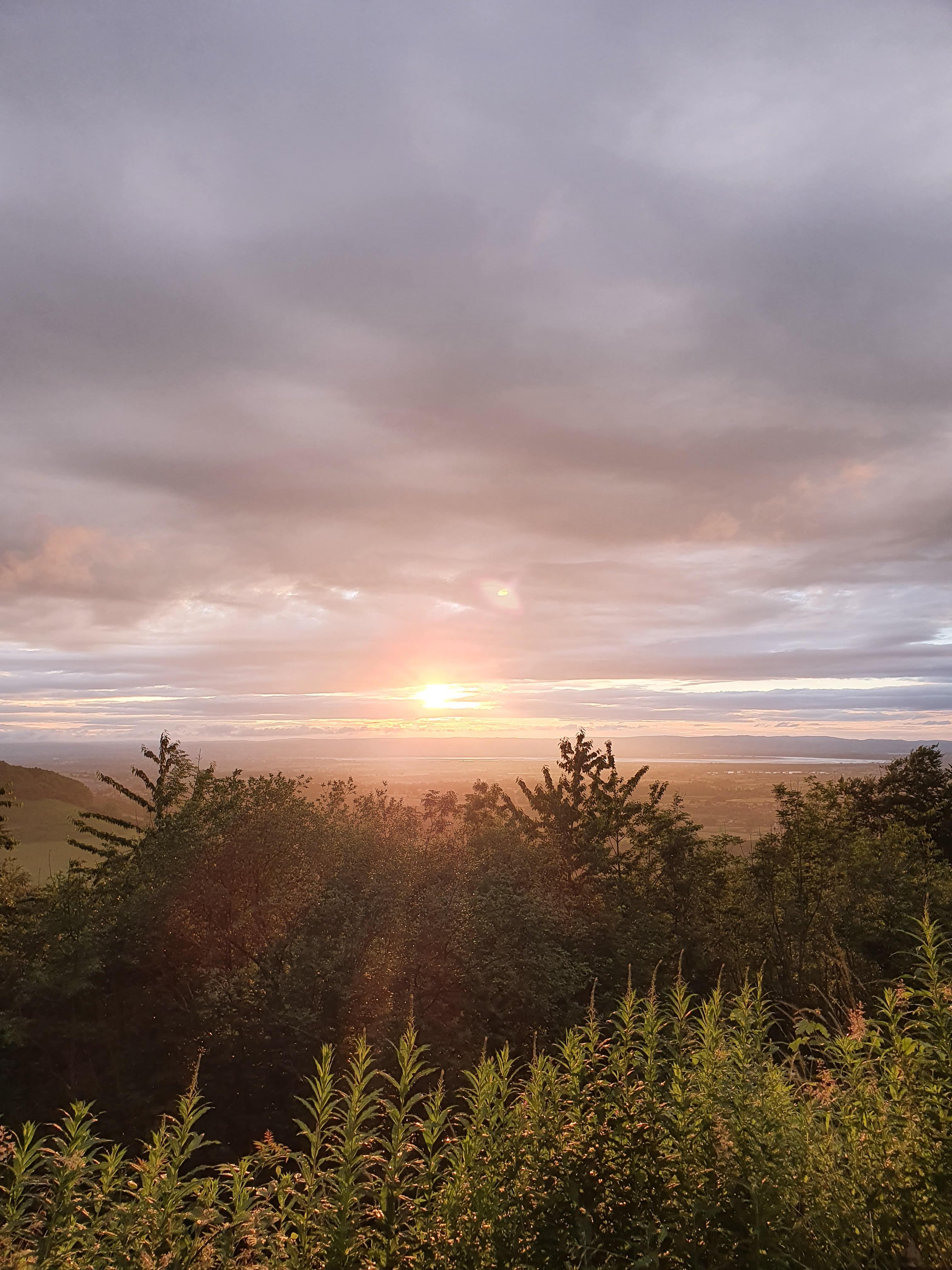
In the dense woodland surrounding the barrow we found a hidden spot to pitch our tent and headed out to eat our cold-soaked noodles and watch the sun set over the rolling hills.

Day 2
After packing up early and leaving no trace of our camp we headed for Cleeve Hill, the highest point on the trail which was disappointingly in the middle of a golf course. But we took advantage of this, stopping with a fellow hiker we’d met that morning at the golf course café for a coffee and a short rest.
The trail crosses Cleeve Common with views over Bishop’s Cleeve and over to Cheltenham, as the route takes an undulating journey, following peaceful tracks and lanes towards Crickley Hill Country Park. Its café and amenities closed upon our arrival, we found a disabled toilet still open and were able to top up our water bottles and keep hiking. (Do be sure to check the café opening times if you are relying on it for resupply.)

Day 3
At mile 42 we woke in the woods, with light rain and a canopy of sun-dappled leaves, our legs were weary but re-energised. We packed up and made our way through the Cotswolds Commons and Beechwoods, beautifully green and lush and even more magical on a rainy but bright morning.
We found ourselves climbing Cooper’s Hill, which felt strangely familiar… Then it dawned on us, that this steep hillside is the scene of a famous annual Cheese-Rolling event, during which the daring participants chase a rolling Double Gloucester cheese down the 200-yard-long hill which at times reaches 45-degrees. (Check out the documentary ‘Cheese Rolling’ as part of the Netflix series We Are the Champions.)
The trail then heads towards ‘The Queen of the Cotswolds’ and the halfway point, the town of Painswick and one of the best-preserved settlements in the area. Set in the heart of the Cotswolds, it’s a must-see spot and you guessed it… More pubs and cafes, and a shop to resupply. It is also home to the oldest building in England to house a Post Office, ironically found on ‘New Street’ and the oldest bowling green in the country.
Heading out of Painswick the trail takes you over grassland and into woodland, over Haresfield Beacon and offers far-reaching views of the River Severn. As darkness set in, we climbed the steep sided Selsley Common to reach mile 62 and found a precarious spot to camp.


Day 4
Waking up to cows licking the tent is not the smoothest start, but we’d found it difficult to find a place to pitch and were forced to camp on the side of the common, so with a rush to pack up and head out we made our way towards the town of Dursley.
Making good time, we confidently strolled through Stinchcombe Hill Golf Club but didn’t realise that there were alternative routes. So be wary and keep your Hiiker App close to ensure you don’t waste an hour walking around a golf course like we did.
The trail takes you to the William Tyndale Monument before you head down into the town of Wotton-Under-Edge, another great resupply and rest spot – we found Parson’s Bakery!
Eventually, full of coffee and bakery goods, we headed out and reached Horton Camp, after scouting for a spot for what felt like forever we settled on a spot at mile 78 of the trail.


Day 5
Our last day would continue to deliver rolling hills and views as we made our way towards Little Sodbury and Old Sodbury, stopping to get a coffee at the petrol station before walking through the impressive Dodington Park, the huge 300-acre estate owned by businessman James Dyson, the garden worthy of a day hike itself.
Crossing fields and pasture the trail takes in Tormarton and then Dyrham, home to Dyrham Park, a 17th century National Trust mansion, garden, and park.
We made it to the pretty village of Cold Ashton for lunch and a view, with just a few miles of the trail left we were able to slow the pace and take it all in.
As the trail winds its way through fields and grassland, you eventually reach Bath Racecourse and are rewarded with views over Bath for the first time. Here you can see just how close you are to the finish.
Descending into Bath though, the trail doesn’t go where you expect, leading you in and then back out and around until finally you find yourself at iconic spots like The Royal Crescent– and then into the centre to find that final acorn outside the Roman Baths themselves.
What a perfect finish!

Things to know before you go
- Water – We hiked in early July and the temperature reached the late 20s, which meant we needed plenty of water, but there are not a lot of taps, and we added any we did find to the Hiiker App. Consider stopping at pubs and cafes along the way to ensure you keep your water topped up.
- Camping – Despite the trails popularity there are very few campsites and wild camping was tricky due to the trail’s proximity to towns so planning your accommodation is key to an enjoyable hike. There are plenty of other accommodation options along the way.
- Transport – we decided to park our car in Bath using the app JustPark and got a lift to Chipping Campden. Being a small village there aren’t many direct links, but it is possible to get there via bus. Research and plan your trip before setting off as you may need additional accommodation depending on the public transport times.
We created a trail video of our Cotswold Way Thru-Hike, you can watch below!
