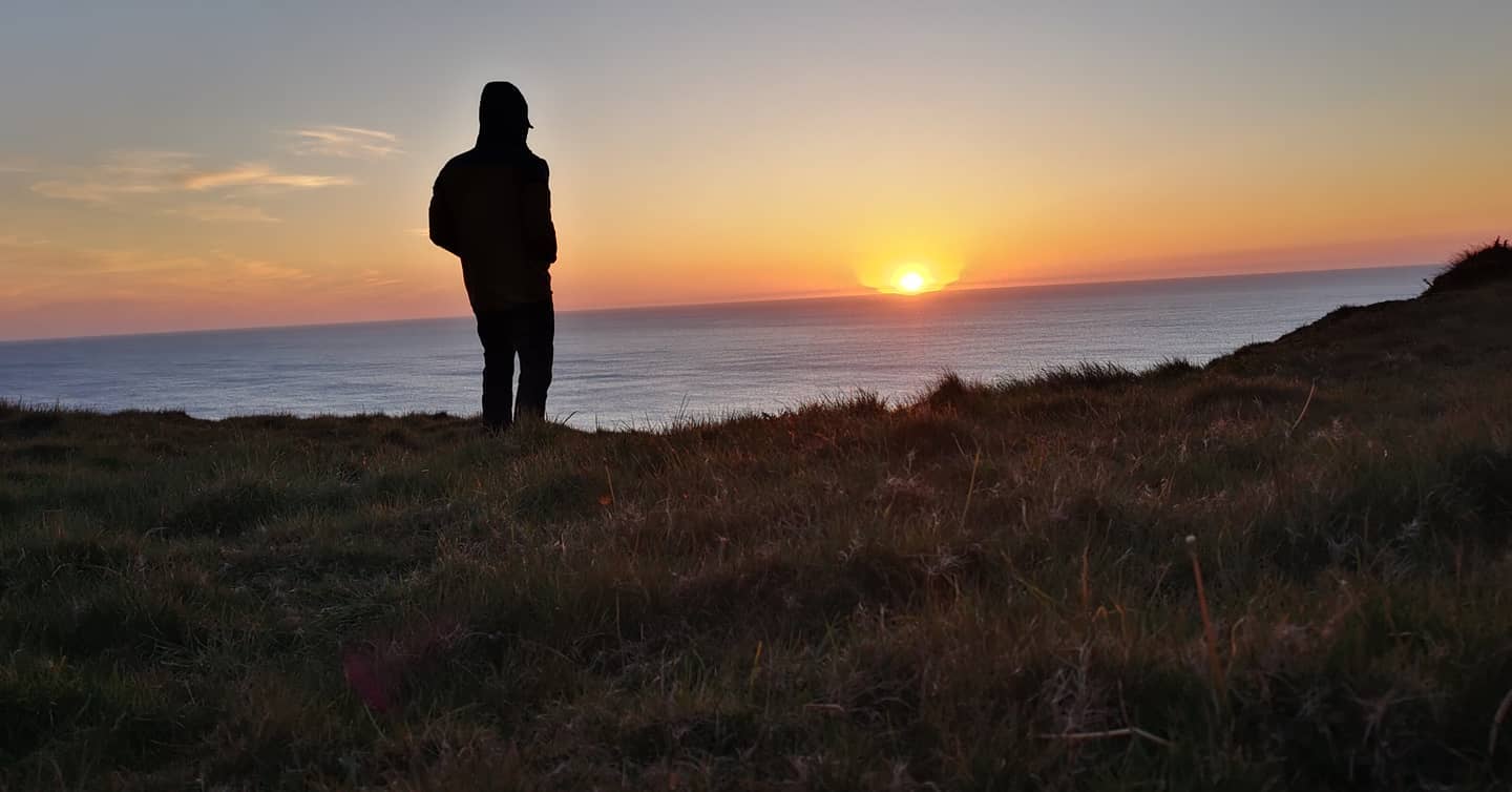
I’m delving into the differences between the Land’s End to John O’Groats trail and the End to End trail; looking at what makes them tick and chatting to hikers, Impala on Trail, Paul O’Donnell & Gareth Turner, about their thru-hikes in 2021.
What is LeJog?
Land’s End to John O’Groats, or ‘LeJog,’ is a long-distance hike that can be walked in both directions between the most south-western tip of England, Land’s End, stretching to the most north-eastern tip of Scotland, John O’Groats. You can also walk it south, ‘JogLe’ or take an indirect route, ‘End to End’.
By road, the route is 874 miles, but LeJog is a thru-hike like no other with not one set trail but rather it’s a mash-up of many; a route stitched together out of necessity and passion for the long-distance trails.
Best hiked between March and October for maximum daylight hours; you’re looking at around 1,200 miles to walk it, but the actual miles depend on the route taken. Make it a meander and take in the scenery, or make it a mission and go for the most direct route possible.
Any long-distance trail can be tweaked but this one, in particular, seems to welcome customisation in a way that many don’t. But if the freedom to change it up and route planning doesn’t float your boat then just stick to the suggested routes of the hikers before you. The good news is, that Hiiker has both mapped out for you, but even with these routes, you have scope to customise your LeJog trail.

So, what is the difference between the LeJog and the End to End trails?
There are many versions of the great walk from Land’s End to John O’Groats but at the core of it you have:


- Land’s End to John O’Groats or ‘LeJog’ is the most direct hike, walked mostly south to north with the prevailing wind, or JogLe from north to south, starting with the hardest sections and most dramatic landscapes.
- End to End or sometimes known as ‘E2E’, is a longer route that seeks out the hills and coastlines and avoids road wherever possible; opting instead for track and path. Plus, it’s great for those wanting to bag some existing long-distance routes on the way.
Unlike other long-distance trails that are easier to follow in the traditional sense, with a waymarked footpath, for this one you set the rules; you decide whether you’re going to use a ferry crossing or walk around the headland. You decide whether to follow existing trails or take the most linear, straight-forward route.

To go direct or take the scenic route?
For some, the most direct route is a priority, avoiding any unnecessary extra miles and getting it done as efficiently as possible because the mission is LeJog. This also may be the case if you’ve already hiked some of the existing trails, for example, the Pennine Way, which means all eyes are on John O’Groats, even if that does mean more tarmac underfoot.
If this sounds like your bag, go for the Land’s End to John O’Groats Trail.
For other hikers though, the End to End Trail is a chance to avoid the road as much as possible, to take that coastal trail or bag that peak and wind their way up (or down) the UK, ticking off some bucket-list hikes on the way, even taking other detours as they go to hit those other smaller long-distance trails from start to finish – no matter of the additional mileage.
If this appeals more, choose the End to End Trail as a guide for a more scenic longer thru-hike, and if you do want to change it up, you can.


LeJog or JogLe pros & cons
LeJog takes the most direct route, takes on fewer miles and takes on more tarmac which can be more efficient and faster if there’s a deadline spurring you on. It’s not all road, LeJog still takes you on existing trails, such as the West Highland Way. However, road walking is harder on the feet and can also be more mentally taxing so whilst it’s still a wonderfully scenic route, road means avoiding some of the most beautiful scenery.

End to End trail pros & cons
The End to End trail gives you a taste of some of the UK’s most loved National Trails and offers up the choice of thru-hiking or sectioning some great bucket-list routes, from the South West Coast Path, the Offa’s Dyke Path and the Staffordshire Way, to the Pennine Way, St Cuthbert’s Way, Southern Upland Way and one of the UK’s notoriously tough trails, the Cape Wrath Way.
However, beautiful coastlines, country tracks and hilltops mean a more rugged, undulating path that will add miles and time to your journey and put your fitness to the test from day one.
Don’t take my word for it, hear about the trail from the hikers
In April 2020, long-distance enthusiast and all-round hiker-king ‘Impala on Trail’ set out to encourage a mass start of LeJog/End to End, encouraging anyone living near the trail to “follow, join or do trail magic.” The hope was to replicate the kick-off hype of a great US thru-hike. There weren’t hundreds of hikers but the comradery was real and so was that collective excitement that only comes with beginning a great journey.

Some hikers were sticking to the more direct LeJog route, others followed the End to End trail, whilst Impala and some others took inspiration from both and mixed it up as they went.
I went along for the first two days to be a part of the buzz and despite not being able to join the thru-hikers for the whole hike, we loved being a part of the great kick-off!
I recently spoke to Impala, Paul and Gareth who thru-hiked from Land’s End to John O’Groats in 2021; they told me about the highs, lows and advice they’d give to anyone planning their LeJog or E2E hike.

So, how was your thru-hike from Land’s End to John O’Groats?
Gareth: “I had the most wonderful craziest great adventure in a country I didn’t realise I knew so little about.”
Impala: “It was absolutely stunning! It’s such an awesome route, I loved every step.”
Any stand-out highlights?
Impala: “I think most people’s favourite part of the trail is Cape Wrath – it’s understandable, it is the best backpacking trail in the UK.
But there are loads of other great sections, especially around the midlands, I thought it was going to be hell but it was actually really nice – there are some beautiful little areas.

Paul: “For me, the high was definitely the SWCP, or it could have been the buzz setting off in a group and the excitement of the whole journey. I loved walking across the bridge to Wales until midway when it started to sway slightly! I had a good mental pick up getting to Chepstow knowing I’d be back on a National Trail not having to check my nav as much.
I loved the Offa’s Dyke path, and once you’re off OD it’s a series of paths and trails again through Shropshire to Staffordshire. Penkridge was the next big town with plenty of food options then you head along a lovely canal path up towards Cannock Chase which was a real highlight.
The Southern Upland Way was better than I expected with some amazing woodland trails, rivers and a few shops and cafes slightly off trail. And although the JOG (John o’ Groats) trail was a bit crap being overgrown with nettles, it had epic views. Look out for marine life – some hikers have seen whales.”
Are there any ‘easy’ sections?
Impala: “There are lots of easy sections. St Cuthbert’s Way, that was pretty easy – that’s a steady cruise.”
What was the hardest part of the thru-hike for you?
Paul: “Union Canal is torture on the feet! And I think having in my head that the highlands would be the toughest section I overloaded with food leaving Fort William. It was a real struggle with my pack along the Great Glen Way.”
Impala: “Nothing was massively brutal. I know a lot of people were stressing about the Cape Wrath trail and doing the cross-country bit from the west to the east through Scotland because it looks like it’s all off-trail but it ain’t that bad, because you’re off trail for a few hours and then you’ll hit a gravel road and cruise on that for a bit, so it’s not nearly as bad as people make out.”
Did you find any parts more mentally challenging?
Paul: “The first bit of pathless section can be a big downer. But I kept saying to myself there are only about 3-6 miles of it per day. The scenery often picked me up mentally.
The long cycle paths and canal paths in Scotland were big negatives on the feet which got mentally draining but music gets you through or an audiobook, podcast, food – anything to take your mind off the same monotonous concrete path.”
Your vote for the best places to stop on the way?
Gareth: “You must try a Cornish Cheese pasty in St Ives and you must eat at The Gorse Bush in Kinlochewe. And the Oykel Bridge Hotel has ‘hiker rooms’ available that don’t come up on Booking.com but you can ring them up and book directly, plus they also have a hiker box!”

Impala: “Hundred percent the best place on the whole trail (and in the universe) is the Pitstop on the Pennine Way – it’s just cool as hell. Like proper American trail magic but in Northumberland – it’s beautiful, I love that place.”
Paul: “The Falkirk canal tunnel, and definitely the Falkirk Wheel. If it’s in operation it’s definitely worth stopping to watch.
In Kinlochewe there’s a village shop and a pop-up cafe in the village hall – it’s 180 miles until the next shop! But there is a pub/restaurant at Oykel Bridge 40 miles from Kinlochewe, they also accept hiker parcels if you want to post ahead. And the Crask Inn, 80 miles from Kinlochewe, I knew I’d arrive there around 8/9am so I phoned ahead the day before when I had signal and asked if they do breakfast. Lovely place!”
Did you stick to the route or customise it?
Impala: “A little thing I did and I think others did too; because the end to end takes you off the Pennine Way and you skip a good section of the start; I personally went a bit funky on my nav and started at Edale and did the complete Pennine Way which I think is well worth doing.
It’s the only thing I don’t like about the End to End, it links these long-distance trails but you don’t do a ‘true thru’ with all of those long-distance trails, hopping on at like 20 miles from the start or from the finish and you’ll just do a section of it. You could go back and link up all these smaller trails.”
Paul: “I detoured from the End to End trail to start the West Highland Way at Milngavie to thru [hike] the trail. And I did the same with the Pennine Way too.”


What would you say to a hiker planning their first Land’s End to John O’Groats thru-hike?
Impala: “If I was going to do it again, I’d do a true-thru [hike] (completing all the long-distance trails on the way) northbound and I would kick off the backend of April, or early May.
Also, I know a lot of hikers psych themselves out from doing Cape Wrath so they end up doing the Great Glen Way and the then up the John o groats trail but I’ve heard a mixed bag about that – that it can be quite sketchy; exposed, narrow paths on the edge of cliffs etc. So, I would stay true to the thru on the end to end route.”
Paul: “Bratton Fleming to Wheddon Cross through Exmoor is the first real navigation challenge. Switching from different public footpaths to trails to country roads. Keep an eye on your nav!”

Make use of the bothies after Fort William to Watton. Even if just for a break or lunch, it’s good to hide away from the midges.
The elevation [on the SWCP] was tougher than I expected to begin with but always remember to look back. Those coastal views were awesome – hence why I’m going back to thru the trail.”

Interested in Hiking the End to end trail?

Interested in Hiking the LeJog trail?
To follow more of Impala and Paul’s adventures, you can find them on Instagram: