Ireland’s west coast is known the world-over as one of the most scenic places on planet earth. It’s dramatic sea cliffs, verdant landscapes and towering mountains make it a mecca for adventurous spirits. The more popular region to visit as a hiker is the southwest, which includes notable regions such as Killarney National park and the Beara Peninsula.
But out beyond these, lies a place once named “The most beautiful place on Earth” by National Geographic – Dingle. Or more explicitly, the Dingle Peninsula.

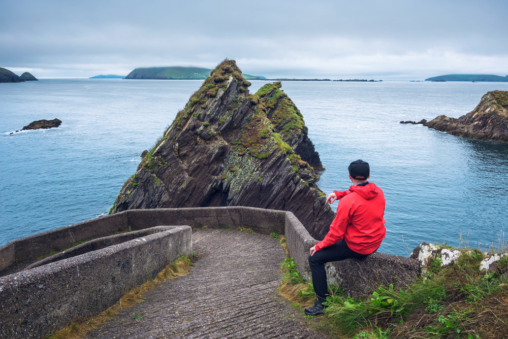
Starting at the gateway to the peninsula – Tralee, the 583 sqm Dingle Peninsula is home to some of the most spectacular hikes in the country and rivals some of the best hikes in the world! It is also home to some fantastic beaches, restaurants and (of course) pubs!
Let’s have a look at some of the best experiences on offer in the “most beautiful places on earth”.
Hiking Trails:
Here is a small selection of the best hiking trails on HiiKER.
Anascaul Three Peaks loop

This 7km loop starts in the historical hometown of Irish explorer, Tom Crean, Anascaul. It takes you on a moderate to difficult climb along a ridge of three hills, offering stunning 360 views of the Kerry Coastline. You can even see down to the McGillicuddy reeks on a clear day. Don’t forget to stop in the South Pole inn for a well-deserved pint after your hike.

Ballydavid Cliff walk

This is an easy 5km out and back route that offers walkers spectacular views over Smerwick Harbour on the west of the Peninsula.

Mount Brandon (Faha ridge)

This is a very difficult trail – only attempt if you have a good level of fitness and are experienced with exposure at heights.
Yes, it is quite a challenging route and the exposure can be a little anxiety-inducing. But if you are up to the challenge, this hike will blow your mind. Mount Brandon is the Highest mountain in Ireland (outside of the Reeks and from the top, you feel like you can almost see across the Atlantic ocean to the US.

Cruach Mhartain

If you’re chasing spectacular mountain top views, but don’t have a full day to commit, then head up to Cruach Mhartain, just a short drive from Dunquin harbour. This 2km moderate out and back trail will take you to the summit of Cruach Mhartain, offering you 360 views of the surrounding coastline of the west of the peninsula.

The Dingle Way

For those seeking the full experience of what the Dingle Peninsula has to offer and time is not hugely limited, then the Dingle way is the best option. Spanning 184km, from Tralee, out and around the entire peninsula and back to Tralee, this is the perfect journey for those looking to immerse themselves in the beauty and culture of Dingle. Some of the key towns and villages that must be seen along the way include:
- Camp
- Anascaul
- Dingle (of course)
- Ventry
- Dunquin
- Brandon quay
- Cloghane
- Castlegregory
We also have a full guide to the Dingle way, written by one half of Tough Soles, Ellie Berry. Read her complete guide to hiking the Dingle Way here.

Other points of interest on the Dingle Peninsula:
- Gallarus Oratory: On your hikes, don’t miss the 1,300-year-old Gallarus Oratory, one of Ireland’s best-preserved early Christian churches. Its dry-stone construction has withstood the elements for centuries, symbolising the endurance of Irish culture.
- Dingle Distillery: After a long day of hiking, a tour of the Dingle Distillery can be an excellent way to relax. Learn about the art of Irish whiskey-making and savour the local brew.
- South Pole inn: You can’t skip this pub located in Anascaul, the hometown of legendary adventurer Tom Crean. The perfect spot for a post-hike meal (and pint).
- The Great Blasket Center: With stunning views of the Great Blasket Island from the windows, the center commemorates the lives of those that lived and worked on the island, before modern life drove families to the cities and towns of the mainland. The island itself is a tourist destination, but only inhabited by a single family to tend to the land.

Why is Dingle the Most Beautiful Place on Earth?
Dingle’s beauty lies not just in its picturesque landscapes but also in its vibrant culture, steeped in history and tradition. Hiking through Dingle is an immersive experience that combines natural beauty with historical intrigue. The people of Dingle, with their warm hospitality and fascinating stories, add another layer of charm to this beautiful place.
From the vibrant shades of green that cover the rolling hills to the striking blues of the Atlantic Ocean, the colours of Dingle are enchanting. Add to this the melody of traditional Irish music that often fills the air, the taste of fresh seafood, and the magic of ancient folklore, and you get a sensory experience that elevates Dingle from merely being a beautiful place to a truly enchanting one. This, in essence, is why Dingle stands unmatched as the most beautiful place on earth.
Maps of the Dingle Peninsula
There are a couple map makers who provide excellently detailed maps for the region. Ordnance survey Ireland have full national coverage of the island of Ireland in 1:50,000 scale mapping.
For more detailed mapping, you cannot go wrong with EastWest Mapping, who launched their Dingle peninsula maps earlier this year. EastWest mapping also have extensive coverage of the top hiking locations in Ireland.
You can explore both of these mapping providers on HiiKER with a PRO+ subscription.
