
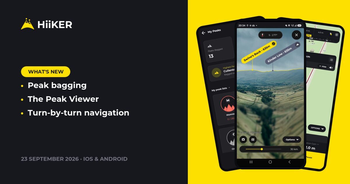
Rolling out now on iPhone, Apple Watch, Android and Wear OS. Update from the App Store or Google Play to get it.
This is the big one. HiiKER is now a peak bagging app as well as a hiking one: walk over a summit with a recording running and HiiKER bags it for you, and keeps your progress through every round you’re working on. Alongside it, two more things we’ve wanted for a long time — a Peak Viewer that names the mountains in front of you, and turn-by-turn guidance that talks you through a planned route with no signal at all. And if you hike with a watch, your heart rate now comes home with every recording.
⛰️ Peak bagging — walk it, and it counts
Start a recording, walk over a summit, and that’s it. No checking in, no tapping anything on the top. HiiKER reads your recorded track and bags the peak for you, then updates every round that summit belongs to.
- My Peaks — everything you’ve climbed, your highest summit, and every round you’ve started
- Hundreds of lists — Munros, Wainwrights, Corbetts and plenty besides. Browse the catalogue, filter it by country, and star the ones you care about
- A list’s own page — your progress, a map of every summit on it, and hikes picked to move you up it
- Leaderboards — every round has one. See who’s furthest through it, where you sit, and how many peaks separate you from the place above
- A celebration when you get there — a full-screen moment on the summit, which you can turn off if you’d rather not have it
- Relive it on your flyover — your recording’s 3D flyover now slows down at every summit you bagged and celebrates it right there on the map, with the list it counts towards and how far through it you are
- Tap any summit for its height, the lists it belongs to, and every route in HiiKER that climbs it
- See a peak in 3D — fly around any summit before you commit to the walk
It’s free. Peak bagging isn’t a subscriber feature — it works on every account, on both apps. There’s a fuller explanation of how a peak gets bagged in Peak bagging in HiiKER: walk it, and it counts.


📡 The Peak Viewer — name every peak on the skyline
Hold your phone up to a view and HiiKER labels the mountains in front of you: what each one is called, how high it is, how far away it is — and, now, whether you’ve already bagged it.
It works off the terrain itself rather than a photo, so it knows what’s hidden behind what, and it’ll pick out summits well past the horizon. Hold it up to a ridge and it locks onto the skyline your camera sees, then stays there as you pan across the view. You’ll find it in the map options sheet. It’s part of a HiiKER subscription, and everyone gets one free look the first time it’s offered. More on it in Peak Viewer: identify every peak you can see.


🧭 Turn-by-turn guidance while you walk
Follow a planned route and HiiKER now talks you through it — a turn banner on the recording screen, counting down to the next turn and spoken aloud, plus a directions list for the whole walk. Turn-by-turn is part of HiiKER PRO, and it’s switched on for you as soon as you subscribe. The Start Navigation button on a hike tells you when its route has turn-by-turn ready.
- It works offline. The directions are worked out once, when the route is attached — after that there’s no network involved at all
- Arrows on the map at every turn, in the planner and while you record, so you can see each turn before you reach it
- It tells you when you stray. Wander off the route and the voice says so, then offers to guide you back to the trail or straight on to the finish
- Starting away from the trail? Until you reach the route, the banner tells you how far away it is instead of counting down to a turn you can’t take yet
- Tighter off-route warnings. New 50 m and 25 m settings, with 50 m now the default, so you hear about a wrong turn sooner
- On your watch too, with the turn’s own symbol leading the page
- You can write your own. In the planner, add a prompt at any point on the route, re-word a turn in your own words, change its direction, or hide one you don’t need
- Edits you make on the web planner come through on the phone, and the other way round

❤️ Your heart rate on every recording
Record a hike with an Apple Watch or a Wear OS watch and HiiKER now captures your heart rate along the way. Open the recording afterwards and your average, max and min heart rate sit right under the distance, time and elevation. Recordings made without a watch look exactly as they did before.

📱 Widgets and watch complications (iPhone and Apple Watch)
HiiKER is now one tap away from your Home Screen, your Lock Screen and your watch face.
- Quick Actions: open the map, start a recording or find a hike, straight from your Home Screen
- Shortcut: one action of your choice, on your Home Screen or Lock Screen
- This Month: your distance, elevation gain and hike count for the month, with the last six months alongside on the larger size
- Apple Watch complications: Open Map, Start Recording and Find a Hike, right on your watch face

💾 Download a whole list in one go
Downloading every route up a mountain, or a whole list of hikes, used to leave you with a pile of loose hike cards and nothing saying they belonged together. Now the list itself is the thing you downloaded.
- One card with the list’s name, how many hikes landed, and its total size — and its own page
- Add a map style to the whole list at once, from the page’s +
- Every download now says what it is — Hike, Map area, Recording or List — and you can filter by that. Recordings used to be labelled as hikes, so you couldn’t tell them apart at all
- Manage or delete the list as one thing, rather than hunting down its hikes one by one
We also fixed a bug where a list of five hikes would only ever download three of them.


👤 A profile that leads with your totals
The public profile has been rebuilt. Your totals lead the page now — distance, elevation, hikes — with a way straight through to your full stats, and your leaderboard placings sit alongside them, showing whether you’re moving up.

📍 Share a place, and copy a hike
- Points of interest are properly shareable. Sharing a place used to hand out a Google Maps coordinate link, which opened neither HiiKER nor the place’s own page. It now shares a HiiKER address — and a link somebody sends you opens the place in the app, a summit landing on its 3D view
- Copy any hike. “Copy <hike>” in the more menu takes any hike you can see — an official trail, someone else’s public route, or one of your own — and makes it a hike you own, ready to change
- A new bar on the recording screen — Download, Directions, More and Start, instead of a single start button with everything else buried
🗺️ Map options, redesigned
The map options sheet was one long list to hunt through. It’s now switches up top, then Navigation and Tools laid out as tiles you can actually scan.

🎬 PRO+ video options on the share wizard
Sharing a flyover now offers three toggles before you export: hide the HiiKER logo, hide the stats panel, or skip the intro and outro and start straight into the flyover.

✨ Also in this update
A few more things worth knowing about. Some of these reached iPhone in the last update and are new on Android now.
- The planner gets straight to it. It opens on your route, with a hint telling you where to long-tap next until you have a start and a finish
- Know what your next renewal will cost. Manage Subscription now shows the price you’ll actually be charged, discounts included
- Your points of interest follow you. Switch on toilets, parking or water once and they stay on across every map in the app
- A weather legend you can step through. The weather overlays now have a legend panel on the map that moves the forecast forward and back
- Recordings say where they came from: imported from a file, or synced from Garmin
- 🤖 Your live position on the elevation profile, on the hike overview, while you record and in the planner, now on Android too
- 🤖 Clear your Recent Activity whenever you like, now on Android too
- European Portuguese, plus a full pass over every other language we ship
- 🤖 GPX import on a folding phone no longer spins forever when the phone is unfolded
Plus a long list of smaller fixes across both apps: turn-by-turn, the planner, downloads, map styles and the peak map. There’s plenty for watches too. On the Apple Watch, maps load straight away and routes and recordings stay in step with your phone. On Wear OS, the map follows you again, crown and bezel zoom work reliably, and starting a recording from the watch is more dependable.
As always, this update is shaped by your feedback — keep it coming. Happy hiking! ⛰️