
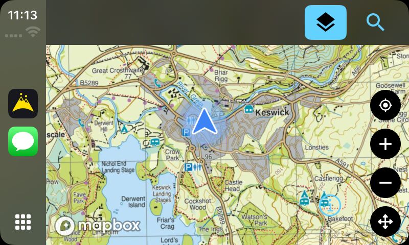
Android drivers have had HiiKER in the dashboard for a while — through DRiiVER, our standalone car app. Now iPhone drivers get it too, built right into HiiKER itself: your saved hikes, your recordings and every waypoint you’ve ever dropped, as places you can simply drive to.
Getting there
Plug in, or connect wirelessly if your car does that, and HiiKER appears alongside Maps and Music. Open it and you get your own map on the dashboard — the same map you use on your phone, in the same style you left it in, with your location on it.

There’s no pairing step and no second sign-in. The car shares the session on your phone, so if you’re signed in there, you’re signed in here.
Finding somewhere to walk
Tap search and HiiKER looks in five places at once: hikes you’ve saved, walks you’ve recorded, waypoints you’ve dropped, the public HiiKER catalogue, and ordinary places by name. Your own things come first, because when you’re sitting in a car park at eight in the morning you’re usually looking for something you already planned.

Leave the search box empty and you get the nearest things to you, closest first. That turns out to be the whole interaction most of the time — no typing, just the pin you dropped last weekend.
The drive
Pick something and HiiKER works out the drive, draws it on the map and shows you what you’re in for before you commit — how long, how far, and which trailhead it’s actually taking you to.

Press Go and it’s ordinary turn-by-turn: the next manoeuvre at the top, distance to it, arrival time and remaining distance along the bottom. It speaks the turns too — a heads-up around 300 metres out, the instruction again as you reach it, and a word when you’ve arrived.

This is navigation to the trail, not on it. HiiKER drives you to the start; the walking still belongs to your phone and your watch.
That’s a deliberate line. Car routing follows roads, and a road router asked to find a footpath gives you nonsense. So the car screen hands over at the trailhead, which is exactly where the app you already know takes it up.
Your maps, on the dashboard
The map styles you pay for don’t stop at the phone. Standard, Satellite, Parks and the Pro layers — Hiking+, National+, Historical+ and Lidar — are all in the car, and switching there switches on your phone too. It’s one setting, not two.


Waypoints, where you left them
Every waypoint on your account is drawn on the car map with the same marker it has on your phone — gates, parking, water, bothies, whatever you’ve been collecting. They’re searchable as destinations, so the pin you dropped at a gate last month is a place you can drive to today.
If you’d rather not look at two hundred markers while you drive, hide them. That’s a map setting only — hidden pins are still in search, because “don’t clutter my screen” and “never take me there again” are different requests.

Moving the map
Car screens don’t hand apps a free-for-all on touch, so panning is its own mode: tap the arrows button, move around with the on-screen arrows, then Done. It’s a small thing, but it means the map behaves the same on a touchscreen, a rotary dial and a trackpad — and plenty of cars only have the last two.

Getting hold of it
CarPlay is in HiiKER 26.82, out now on the App Store. You’ll need an iPhone signed in to your HiiKER account and a car that supports CarPlay — there’s nothing to install on the car side and nothing extra to pair.
The car surface itself is free. The Pro map layers — Hiking+, National+, Historical+ and Lidar — stay Pro in the car exactly as they are on the phone.