
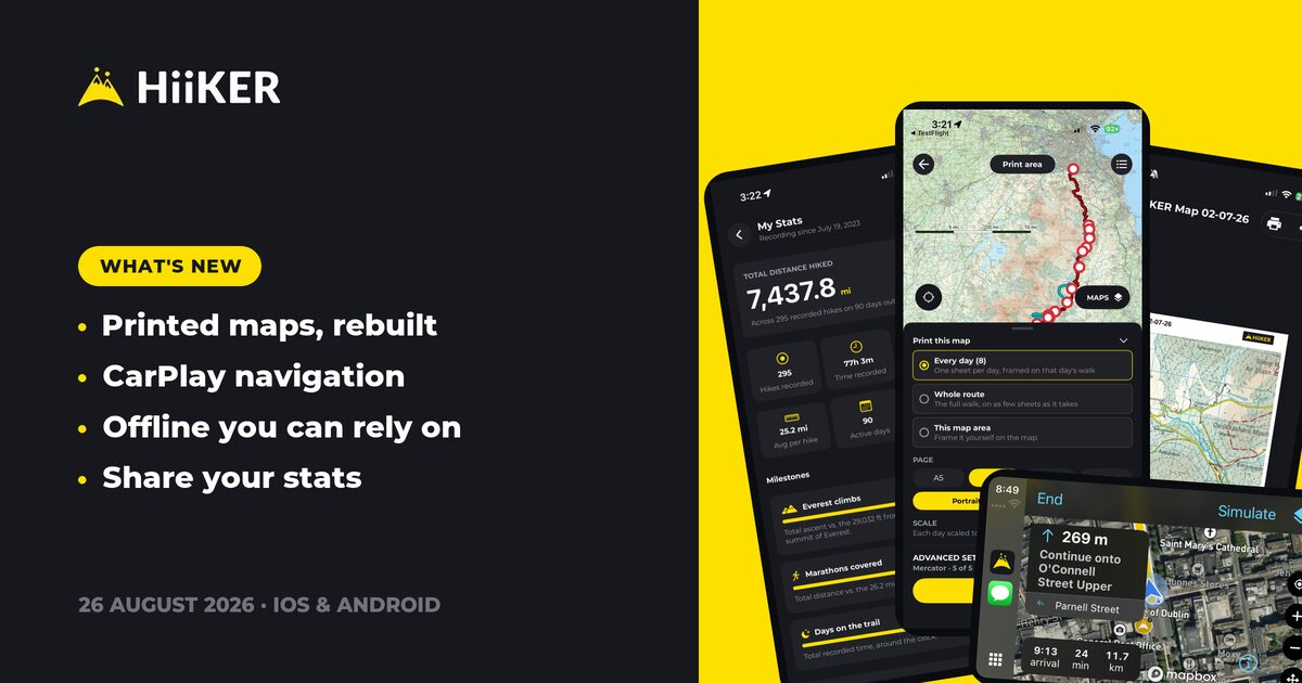
Rolling out now on iPhone, Apple Watch and Android. Update from the App Store or Google Play to get it.
This is one of the biggest HiiKER updates we’ve shipped — two and a half weeks of work across both apps, built around three things: getting a real map in your hand, making offline actually dependable, and turning the car screen into a proper navigation app.
🖨️ Printed maps, rebuilt from scratch
The print screen is completely new — a proper settings sheet and a print queue, so you can set up a batch and let it work.
- Print the whole route, not just the rectangle you framed on screen
- Long routes now prepare in the background behind a loading view instead of locking the app up

📱 On iPhone & iPad: print every day of a multi-day hike as separate sheets in one go, and use “Add another sheet at this spot” to hand-frame a pile of areas along a walk and print them as a single multi-page PDF — previously six sheets meant six separate downloads.
📡 Offline you can actually rely on
Last update made offline content readable. This one makes it workable.
- Edit your own hikes with no connection — changes sync when you’re back
- Continue a recording offline straight from the hike overview
🤖 On Android: downloads got a serious overhaul. Map downloads are up to 20× faster, the Mapbox and HiiKER map layers now download at the same time instead of one after the other, and progress bars sweep up smoothly from zero rather than jumping in mid-scale or sliding backwards. Downloads also survive a flaky network or a rate-limited connection now — and tell you when that’s what’s happening, instead of sitting there looking stuck. And since downloading needs the app on screen, a long download now says so up front rather than quietly stalling once you switch away.
🚗 CarPlay is a real navigation app now
📱 On iPhone: the car screen has gone from a recording surface to a full navigation app — search, map styles, route preview and turn-by-turn directions, with your saved waypoints on the car map and in car search (with a toggle to hide the pins). The map now follows the vehicle instead of drifting off screen, and dark map styles kick in at night. Read the full CarPlay story here.

📊 Share your stats
You can now view another hiker’s public stats and share a link to your own — handy for comparing a season’s mileage with a walking partner.

📝 Recording, tidied up
- Recordings are never saved as “Untitled recording” again — they’re named from the trail you walked
- Pending cards now say what they’re actually waiting for, instead of a vague spinner
- Open a pending recording’s photos straight from its preview map
🤖 On Android: retry a failed upload directly from the pending recording view, waypoint photos whose upload failed are no longer lost, battery saver no longer hard-blocks recording (you get a warning and a two-week bypass instead), and the Wear OS recording map reliably comes back when the watch reclaims the app.
📱 On iPhone: a continued recording keeps its comment, rating and description when you save it again, the recordings list holds its scroll position when you come back from a recording, and the Health permission prompt no longer fires repeatedly.
✉️ Notification and email preferences, rebuilt in-app
Communication preferences are now native to the app on both platforms — faster, and they work properly offline.
🎨 Map and navigation polish
- A comment’s media now leads with its recording’s 3D flyover
- The quick-action icon picker gained the glyphs it was missing
- Search now accepts all-numeric easting/northing grid references
- A tap toggles full screen even with the touch screen locked
- 🤖 Android: the ground under the heatmap is darkened to match the web, and the overlay sits below your hike line
🐛 Fixes and stability
Both: a purchase that gets its entitlement late now completes properly — and says so clearly when it genuinely fails.
🤖 Android: several back-button and tab-navigation bugs squashed, edited routes now show up straight after saving, the Record tab no longer sticks on a black screen after discarding, a failed waypoint sync no longer freezes the app, and an offline-storage upgrade can no longer take the app down on launch.
📱 iPhone & iPad: off-route warnings now monitor every line of a route instead of silently dropping some, search stays alive so Back returns you to your results, sheets and the paywall no longer open behind the search overlay, signing in anonymously no longer creates a duplicate account, and a GPX file without elevation data no longer crash-loops hike sync.
As always, this update is shaped by your feedback — keep it coming. Happy hiking! ⛰️